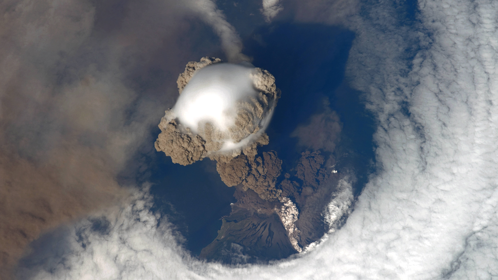
 Crew aboard the International Space Station captured this image of the Sarychev Volcano as it erupted on June 12, 2009. Sarychev Peak is located in the northern part of the Kuril Islands, a Russian archipelago in the northwest Pacific. (Image credit: NASA/JSC/Image Science and Analysis Laboratory)
On June 12, 2009, the International Space Station happened to be passing over the Sarychev Volcano just as it was beginning to erupt. A newly released video based on several stunning snapshots taken by astronauts reveals the beauty and power of the erupting volcano.:max_bytes(150000):strip_icc()/clevelandvolcano-6dbc23e9c39541b5a9016126dfee55dc.jpeg)
The new volcano animation reveals the plume of ash and steam rising from Sarychev. The plume appears to be brown ash capped with a head of white steam, a result of air rising quickly in a strong updraft, before cooling and condensing. “The plume was so immense that it cast a large shadow on the island,” according to NASA Earth Observatory. [See the Sarychev Eruption Animation]